Commercial Fishing and Ocean Planning
As commercial fishing in New England changes, the need for better information, including traditional knowledge, is important. Understanding where and when commercial fishing happens, and how that picture is changing, can lead to improved decisions and help reduce conflicts among new and traditional ocean uses.
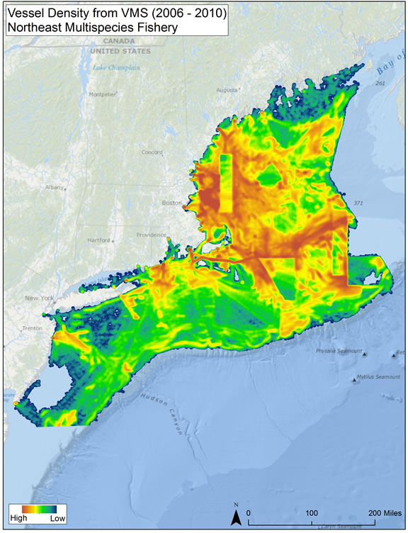
To help enhance that understanding, a project to map commercial fisheries in New England began in 2012. Starting with existing data available for certain fisheries, map products were developed and discussed with the fishing industry, scientists, and managers. A project report summarizes the results of this initial phase, and work will continue to produce more complete information.
This work led to a second phase, which began in 2014, and included:
- VMS maps: adding additional years from 2011-2014, separation of fishing from vessel transit using vessel speed calculations, and incorporating spatial fishery management measures such as closed areas;
- Comparison of map results from various federally available data sources;
- Investigating the best, regionally consistent source of information to map lobster fishing activity;
- Pilot testing an electronic catch and location reporting device for party / charter vessels.
Documents and Reports
Phase I Documents:
- Commercial Fisheries Spatial Characterization, Final Report to the Northeast Regional Ocean Council (PDF) (66pp, 2.2M)
- Commercial Fisheries Spatial Characterization, Appendices B-C (PDF) (38pp, 14.7M)
- Commercial Fisheries Spatial Characterization, Appendices D-G (PDF) (17pp, 1.5M)
- Mapping Commercial Fisheries Factsheet (PDF) (2pp, 743K)
Phase II Documents:

